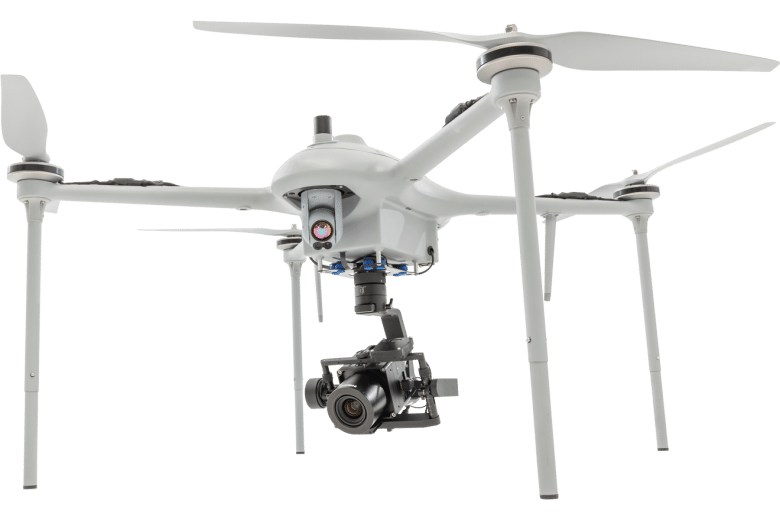
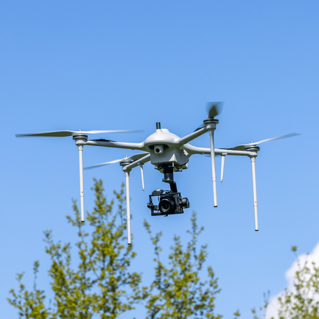
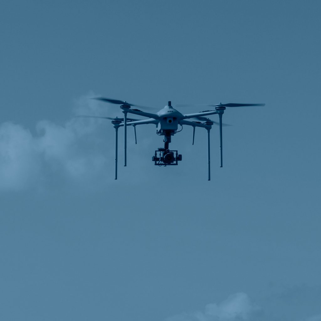
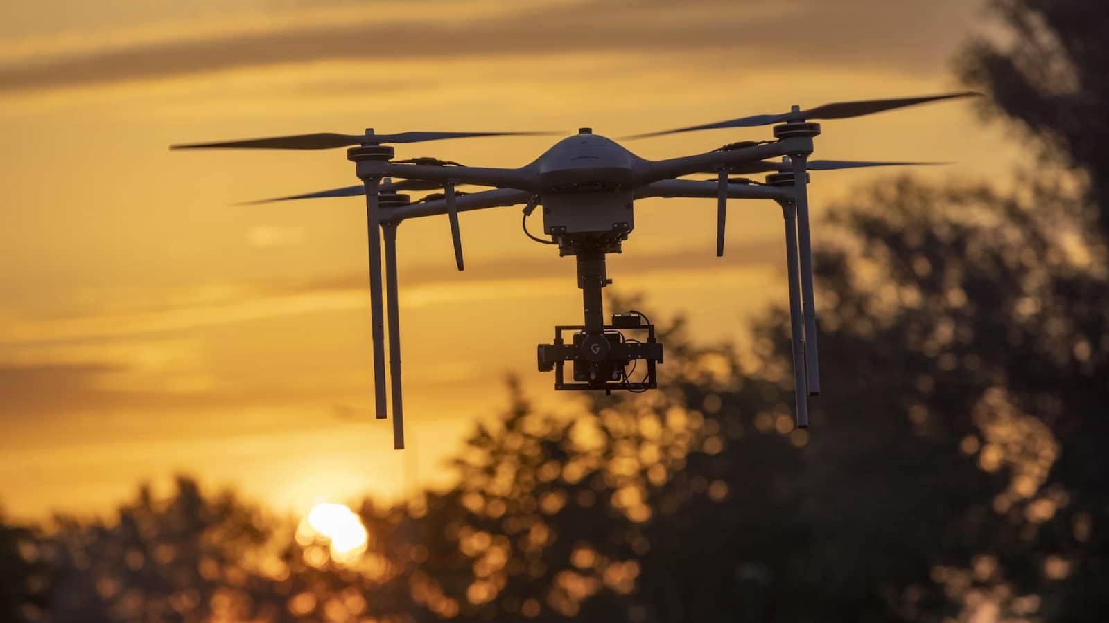
Designed to achieve more surface coverage at extremely high resolution. The MP-3 is a professional mapping, surveying, and inspection tool with the best accuracy and precision to collect reliable aerial imagery data in a fast, safe and efficient way.
The MP-3 is a precision-driven high-resolution aerial imagery solution with a long flight time to achieve more surface coverage. The UAV is a ready-to-fly system that enables users to effortlessly execute photogrammetry mapping missions, capturing high-resolution images for 2D and 3D mapping, and offers unmatched inspection productivity and versatility.
The MP-3 opens the door to new mission types and applications. Whether it’s for inspection or mapping, the combination of the MI-3, the Phase One iXM 100MP camera and, the 3-axis stabilized gimbal enables users to achieve professional results, higher quality images, and more surface coverage in less time – without any risks.
The system is dust and rain-proof [IPX3] and has a flight time of more than 50 minutes including the PhaseOne iXM 100MP camera, a 3-axis stabilized gimbal, and the Applanix APX-15 EI, dual IMU’s.
Even though the MP-3 is designed for more complex missions, the system only needs 1 person for rapid deployment within minutes, ready to perform manual or fully autonomous mapping, surveying, and inspection missions.
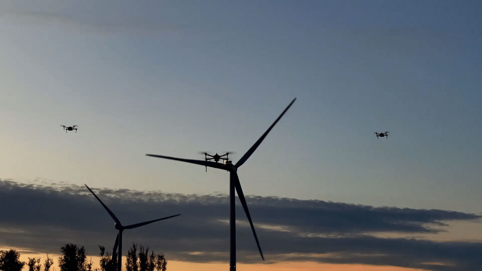
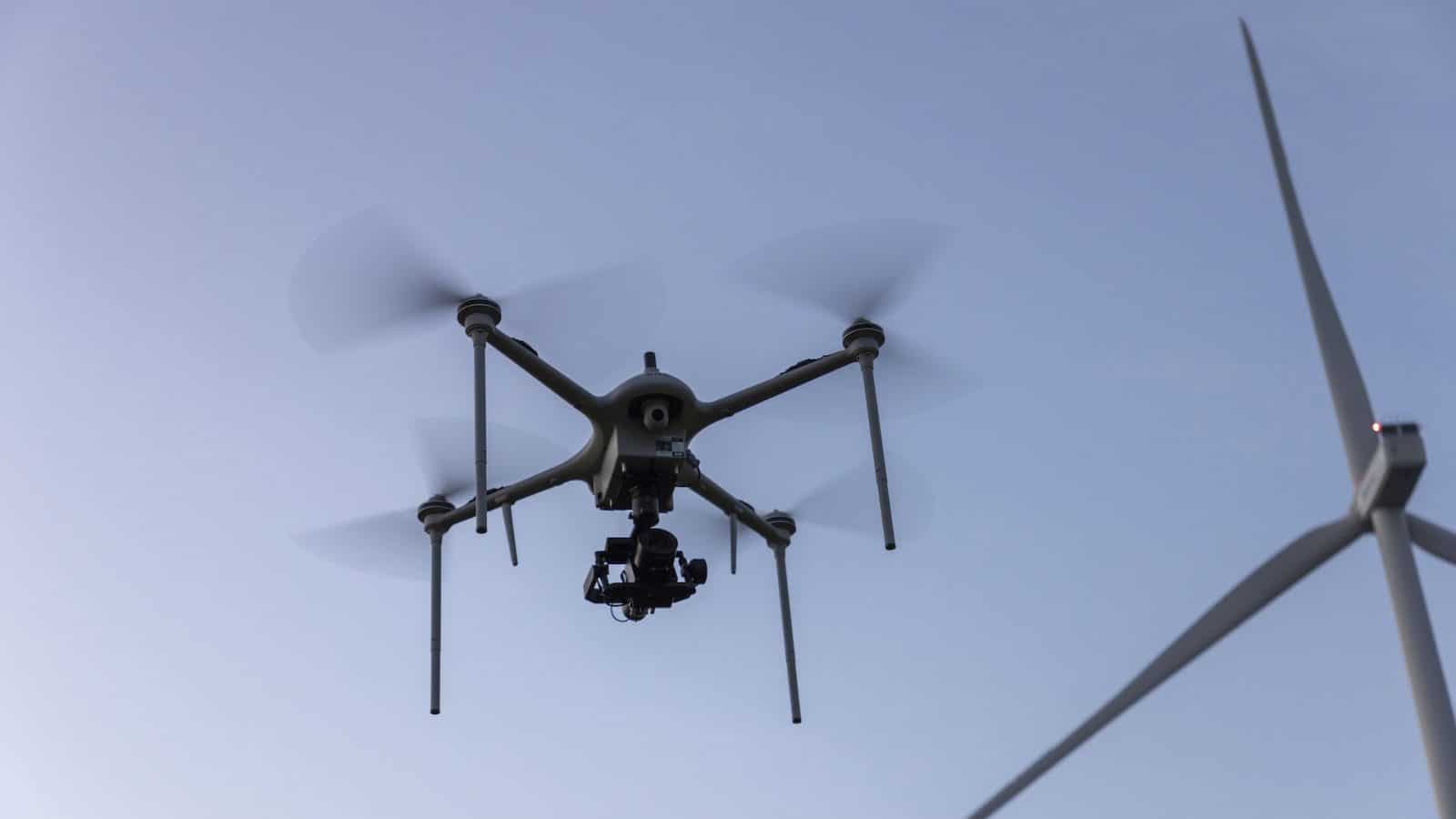
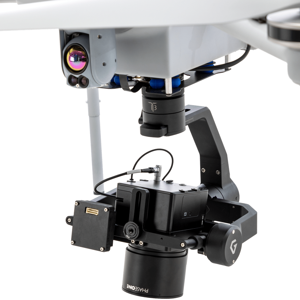
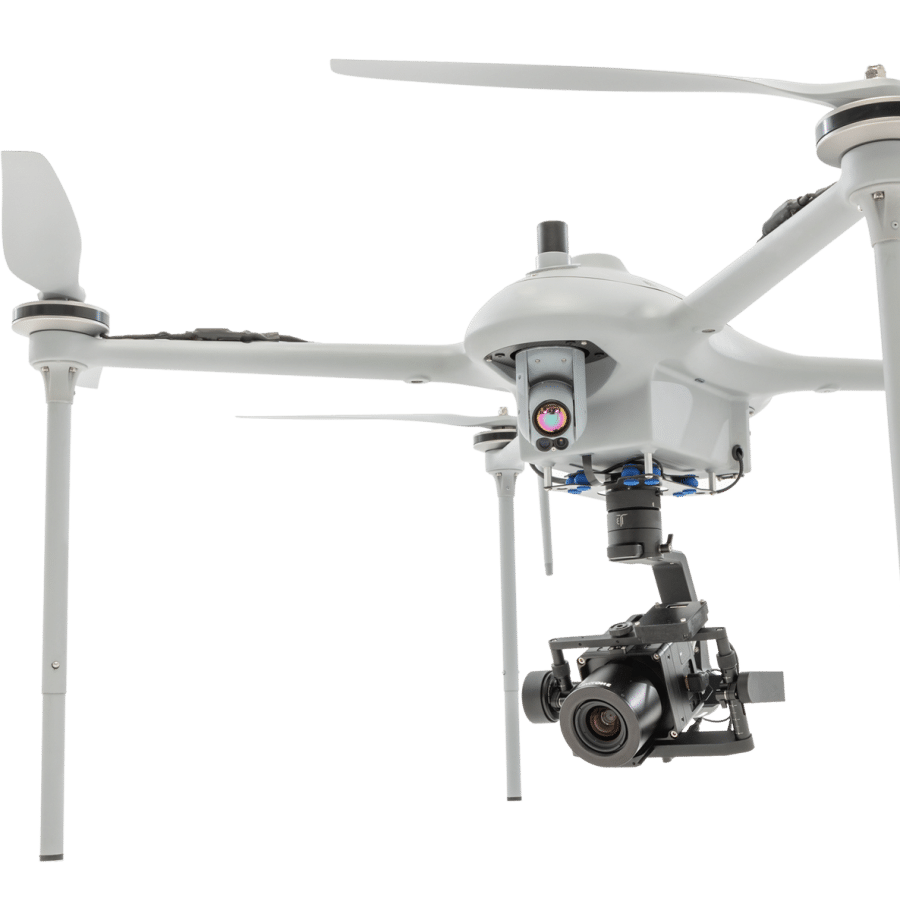
The MP-3 is capable of GPS-denied flights and packed with useful AI (Artificial Intelligence) features to increase its efficiency, effectiveness, and versatility for mapping, surveying, and inspection missions.
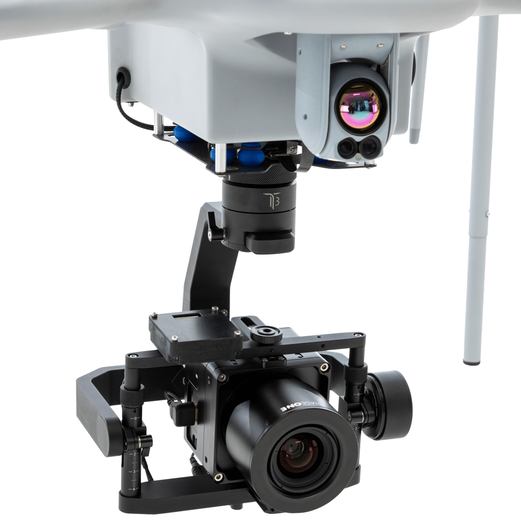
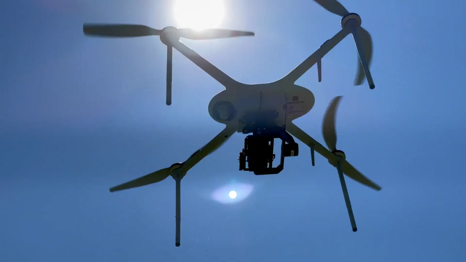
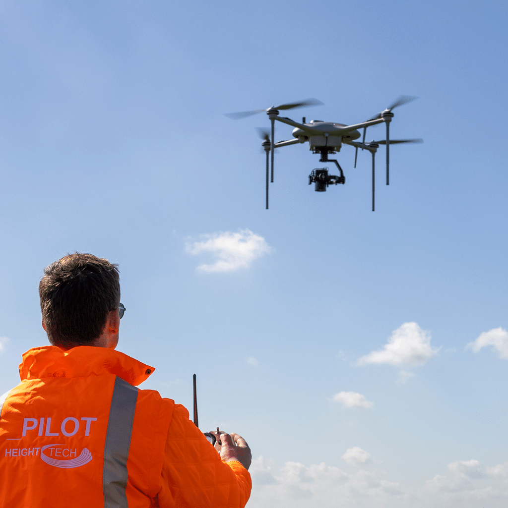
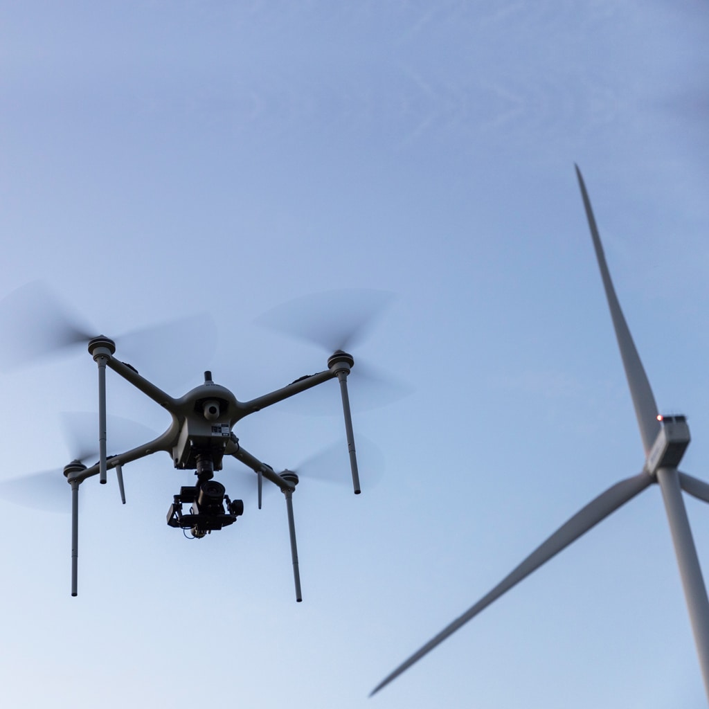
The P2P or LTE encrypted datalink ensures instant access to real-time information for individuals and command posts, even when flying beyond the visual line of sight (BVLOS).
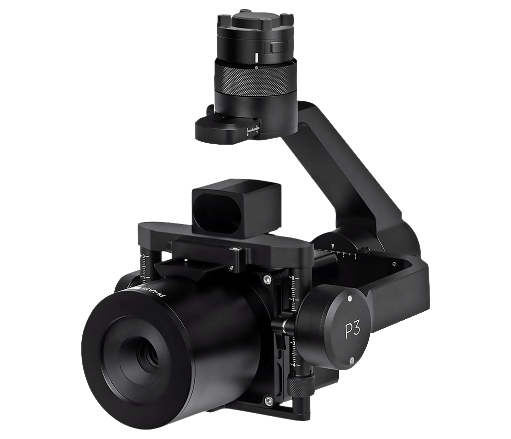
For LiDAR or security/defense applications, the payload capacity of the MP-3 enables advanced LiDAR and tactical sensor integrations. For more information please visit: the MI-3 tactical ISR unmanned aerial system
The iXM 100-megapixel camera incorporates a high-end sensor with backside illumination (BSI) technology for improved highlight sensitivity and dynamic range. The Phase One iXM-100 camera is fast, highly responsive, and robust and is available with a range of high-resolution lenses designed for aerial photography, mapping and surveying, and inspection.
150 meters altitude [AGL]
|
||
---|---|---|
RSM lens | GSD [cm] | HA per single flight |
35mm f/5.6 | 0,97 | 126 |
80mm f/5.6 | 0,42 | 62 |
150mm f/5.6 | 0,23 | 36 |
150 meters altitude [AGL]
|
||
---|---|---|
RSM lens | GSD [cm] | HA per single flight |
35mm f/5.6 | 1,62 | 207 |
80mm f/5.6 | 0,71 | 97 |
150mm f/5.6 | 0,38 | 56 |
250 meters altitude [AGL]
|
||
---|---|---|
RSM lens | GSD [cm] | HA per single flight |
35mm f/5.6 | 2,16 | 275 |
80mm f/5.6 | 0,94 | 126 |
150mm f/5.6 | 0,50 | 74 |
350 meters altitude [AGL]
|
||
---|---|---|
RSM lens | GSD [cm] | HA per single flight |
35mm f/5.6 | 3,23 | 326 |
80mm f/5.6 | 1,41 | 167 |
150mm f/5.6 | 0,75 | 101 |
The MP-3 is a versatile and ready-to-fly system that enables users to effortlessly execute photogrammetry mapping missions, capturing high-resolution images for 2D and 3D mapping.
The system carries the PhaseOne iXM 100MP camera on a 3-axis stabilized gimbal, together with the Applanix APX-15 EI dual IMU. The dual IMU’s eliminate the need to survey extensive Ground Control Points (GCP’s) and reduces the amount of side-lap required per flight.
The MP-3 is a high-performance Direct Georeferencing solution for improved efficiency, cost-effectiveness, and accuracy of mapping. The system has RTK real-time position for precision landing and real-time mapping applications.
This solution grants the professional user a sub-centimeter accuracy and a sub-centimeter GSD, even at an altitude of 300 meters AGL without using ground control points.
Complete visibility across dynamic aerial inspection applications – achieve large surface coverage at extremely high resolution for accurate inspection of the objects and surrounding areas.
Get millimeter-sized damage spotting detection, fast repair, increased performance, and low environmental impact with the MP-3 UAV system and PhaseOne iXM 100MP camera.
Our specifically designed multirotor UAS enables more surface coverage at extremely high resolution. The system provides accurate visualization of the objects, as well as the surrounding areas.
The PhaseOne iXM 100MP camera also enables millimeter-sized damage spotting detection and fast repair, with minimal effect to performance or the environment – making it the ultimate aerial inspection UAV system.
The Mi-1 is a foldable version from our Martlet Series, fulfilling our client's needs for a more portable ISR drone.
Get the most payload capacity and flight time with the portability and reliability of a military-grade multirotor.
Tech Consultant